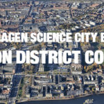
New signs show way to innovative co-creators
Copenhagen Science City may well be the most walkable innovation district in the world. As compact as it is though, visitors have found it challenging to find collaborators in the district. New signage should reduce that challenge.
Maps and “Must See” destinations
Visitors in Universitetsparken, at Titangade and to Rigshospitalet know the signs well. A North-Pole sign pointing towards various “must-see” destinations in the innovation district and pylons, bearing maps, have been showing the way to collaborators since 2016.
Three new locations for wayfinders
Guests with a tendency to lose their way can now rejoice. Both types of sign have undergone a thorough update, and additional signs have been erected at the gateway to Universitetsparken at the intersection of Tagensvej and Ole Maaløes Vej and at the rear-entrance to Rigshospitalet where Henrik Harpestrengs Vej meets Frederik V’s Vej. A third North Pole sign will adorn the corner of Frederik V’s Vej and Blegdamsvej, when the 100,000 M2 North Wing to Rigshospitalet is completed.
Educating co-creators
Maps and signposts are both part of an on-going effort to educate the districts 40.000 researchers, students and staff about the countless opportunities for co-location and co-creation in Copenhagen Science City. With three major institutions for research and education within an 800-meter radius, the area meets every condition to become a world-class innovation district.
Visitors to and users of the innovation district are invited to download and print their own copy of the map here


